

Pendine
Enjoy the views of beaches known for World Land...
Combine this woodland walk with estuary views and a visit to Llansteffan castle
Paddy Dillon
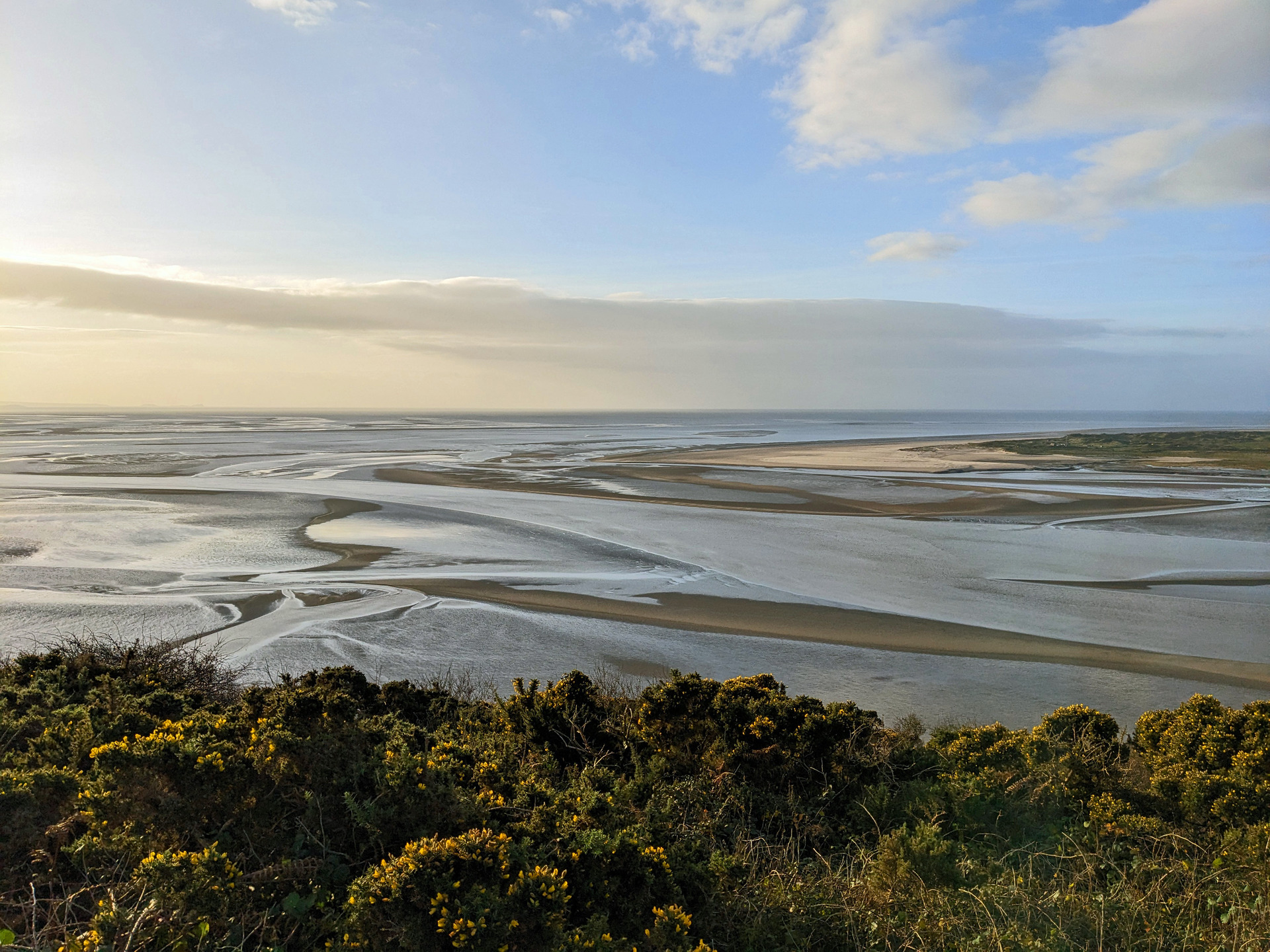
The Wales Coast Path can be followed from Llansteffan to Scott’s Bay and Wharley Point. While most of the path runs through woodland, there are views of the estuary of the River Towy. A route inland runs from Lord’s Park back to Scott’s Bay, then the substantial ruins of Llansteffan Castle can be visited. An exploration of the village can be made before finishing the walk.
Distance: 4.6 miles or 7.4 kilmetres
Start location: The Green, Llansteffan
Start Grid Ref: SN 35456 10856
Start What 3 Words: items.wriggled.verve
Parking
Parking at Llansteffan, using one of the car parks located at either end of The Green.
Bus
Daily bus services, except Sundays, link Llansteffan with Carmarthen.
Train
None.
The circular route is marked in dark pink in the map image below. The purple flags show the start and finish point. View the route and download GPX link 'Llansteffan'

1. If arriving at Llansteffan by bus, get off at the first stop in the village at The Bridge and walk down the road signposted ‘Beach’ and ‘Castle’, which is also followed by the Wales Coast Path. If arriving by car, drive down this road, which is Water Lane, and use the first car park on The Green. If this is full, continue to the other end of The Green and use another car park. Assuming that the first car park is used, simply follow the Wales Coast Path along an embankment overlooking a marsh and the estuary of the River Towy. The marsh is quite wild and wooded in places. A grassy area stretches inland, followed by a row of houses. The village on the other side of the estuary is Ferryside, which can be reached by ferry in the summer. Another car park at the end of the embankment offers a play park, toilets, snack cabins, Beach Shop and Tea Room.
2. Walk inland as signposted for the Castle, climbing along a narrow tarmac path between fields. Noticeboards at the bottom and top highlight features of interest in the area. Turn left down a minor road, and when the road later splits keep right, but almost immediately turn left along a broad woodland path marked as the Wales Coast Path. Keep right to pass an ornamental bench and follow the path down to a stone shelter overlooking the estuary. 37 concrete and stone steps lead down a rocky slope to a sandy beach, but if the beach is visited, it is necessary to climb back afterwards.
3. Keep right at the shelter as marked and walk up a path across a wooded slope, with occasional views of the estuary. The path descends and when it splits, keep right as marked, passing a noticeboard offering information about the estuary. The path rises and falls on the wooded slope, reaching a sea wall, a gate and an arched stone bridge in front of a house at Scott’s Bay. (There is an option to short-cut inland here, omitting the circuit around Lord’s Park, saving almost 2 miles.)
4. Go through the gate, cross the bridge to pass in front of the house and follow the path uphill. Go through another gate and turn right to follow the path further uphill. When another gate is reached, don’t go through it, but turn left up a path marked as the Wales Coast Path, then follow it downhill across the wooded slope. The path runs through woods around Wharley Point and there are glimpses of the widening estuary. The path generally climbs and includes views of the distant Gower and Worm’s Head. Pass a gate and the view is more extensive, stretching to Tenby and Caldey Island in Pembrokeshire. The grassy path undulates across a slope of brambles, bracken and gorse. Go through another gate and there is a view of Laugharne across the River Taf.
5. Pass another gate and the grassy path is flanked by hedgerows as it rises inland and descends to a gate. The Wales Coast Path is signposted left along a farm road, but turn right instead to return to Llansteffan. Pass to the left of all the whitewashed buildings at Lord’s Park. The farm is a National Trust property, dating from the 19th century, surrounded by flower-rich meadows. There are two grassy tracks at the last building, so use the one on the left. The track makes a gradual descent alongside fields, always with an overgrown hedgerow to the right, valley views to the left, and Llansteffan Castle ahead, though this is lost to view later. Go through a gate, briefly following the Wales Coast Path downhill, along a path that was used earlier. Turn left through a gate, cross the arched stone bridge and go through another gate in front of the house at Scott’s Bay.
6. Turn left to follow a path straight inland from the bay and watch for a gate on the left for Ffynnon Antwn Sant, or St Anthony’s Well, reputed to have healing waters since the 6th century. Continue along the path and walk up the access track leading away from the house. Turn right after going through a gate to follow another access track, which soon climbs as a sunken concrete road. The gradient eases after passing a substantial stone house then later a descent leads to Castle Hill Cottage. A broad path on the right climbs steeply to Llansteffan Castle and there is free entry to this extensive ruin. There was an Iron Age fort here in 600BC, while the castle dates from the 12th century and changed hands many times during centuries of conflict. Views from its towers are splendid and include the manor house of Plas Llanstephan, dating from the 16th century. Walk back down the steep path and continue down the road towards Llansteffan. Wales Coast Path markers and signposts will be spotted as this road was used earlier in the day.
7. To finish early, turn right down the tarmac path to return to one or both of the car parks at The Green. To enjoy an exploration of the village, however, keep walking along the road. This leads past St Stephen’s Church to The Square. Turn right along High Street to pass The Inn at the Sticks, Castle Inn, Memorial Hall and Village Store, which has a café. Reach a crossroads at The Bridge, where buses stop, or turn right down Water Lane, signposted ‘Beach’ and ‘Castle’, to return to the car parks at either end of The Green.


